Featured
CoastCams: A MATLAB toolbox making accessible estimations of nearshore processes, mean water levels, and morphology from timestack images
Environmental Modelling & Software, 168, 105800 (2023)
Open-source MATLAB toolbox for quantifying wave parameters, water levels, bathymetry, and morphology from coastal video imagery
Source
Forever
Research
Original CoastCams paper introducing the toolbox methodology
Read Paper →Coastal monitoring is essential for understanding nearshore processes, coastal erosion, and wave dynamics. However, traditional methods are:
CoastCams provides a unified, open-source solution that makes coastal monitoring accessible to everyone:
Capture coastal imagery using land-based cameras
Generate orthorectified timestack images
Process images to extract wave parameters, bathymetry, and morphology
Visualize and analyze coastal dynamics
Comprehensive wave analysis including period, height, and direction
Mean water level detection and tidal analysis
Enhanced depth estimation using wave dispersion
Shoreline detection and coastal change monitoring
Everything you need to get started with CoastCams
Installation guide and quick start tutorial
Detailed instructions and configuration options
Sample workflows and analysis scripts
Methodology and validation studies
Report issues and get help
MIT License - free to use and modify
git clone https://github.com/NuytsSiegmund/CoastCams.git
Add the CoastCams directory to your MATLAB path and you're ready to go!
Real-world applications of CoastCams
Bay of Biscay, Basque Coast
Socoa Beach serves as a primary validation site for CoastCams, demonstrating the toolbox's capabilities in a complex coastal environment characterized by:
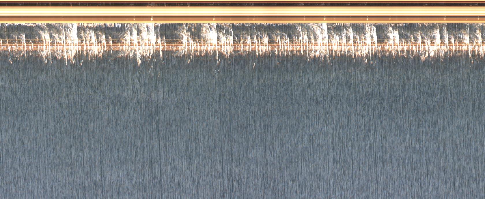
Socoa Beach Timestack - October 13, 2021
CoastCams has been deployed in various coastal environments worldwide:
Researchers and coastal managers use CoastCams for:
Raw Video Frame
Processed Timestack
Oblique Image
Georectified View
Environmental Modelling & Software, 168, 105800 (2023)
If you use CoastCams in your research, please cite our paper:
Nuyts, S., Almar, R., Morichon, D., Dealbera, S., Abalia, A., Muñoz, J. M., Abessolo, G. O., & Regard, V. (2023). CoastCams: A MATLAB toolbox making accessible estimations of nearshore processes, mean water levels, and morphology from timestack images. Environmental Modelling & Software, 168, 105800. https://doi.org/10.1016/j.envsoft.2023.105800